AI-Driven Sustainable Coastal Defense SystemAI 驅動的永續海岸防禦系統
Visualizing invisible ocean risks to build a safer, sustainable coastline.把看不見的海洋風險視覺化,打造更安全、更永續的海岸線。
Solution Highlight解法亮點
1 · Modular Eco-Structure1 · 模組化生態結構
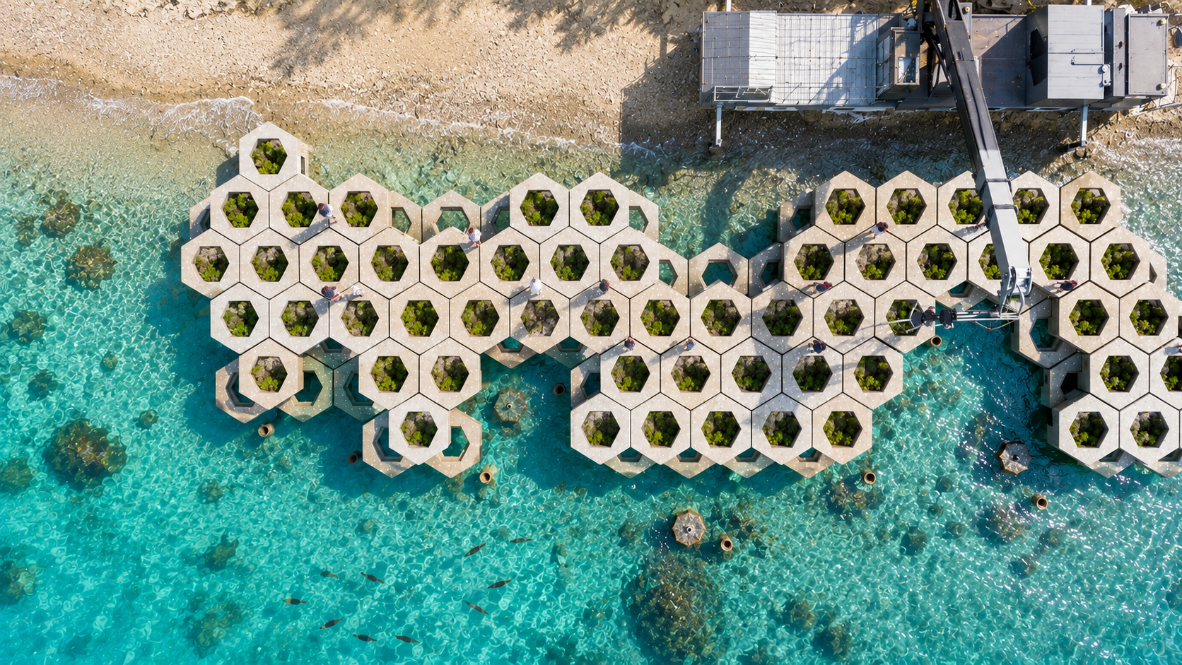
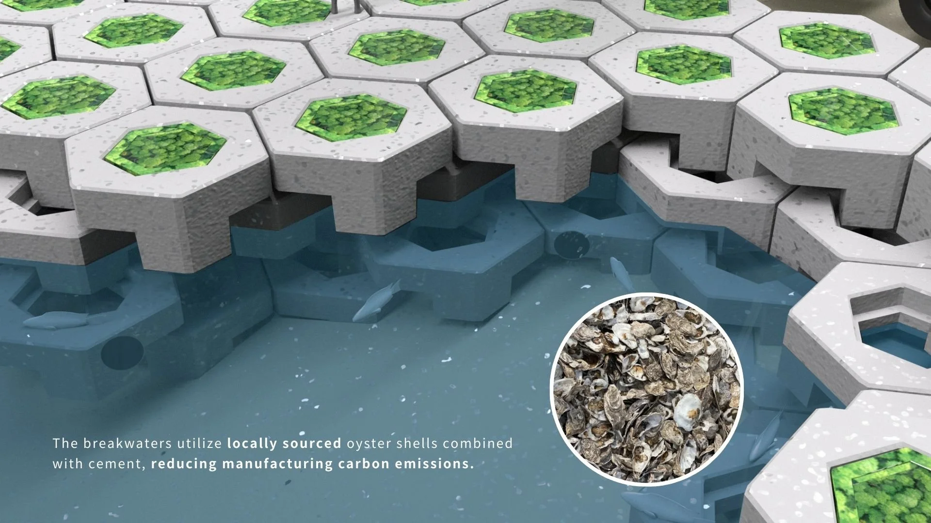
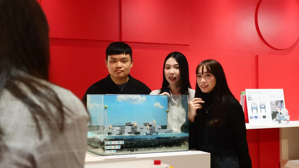
Recycled oyster shells form hexagonal modules, distinct from traditional concrete, designed to stabilize the shoreline while promoting marine biodiversity.用回收蚵殼做成六角形模組,有別於傳統混凝土,既穩定海岸線,又能促進海洋生物多樣性。
2 · AI & IoT Intelligence2 · AI 與 IoT 智慧
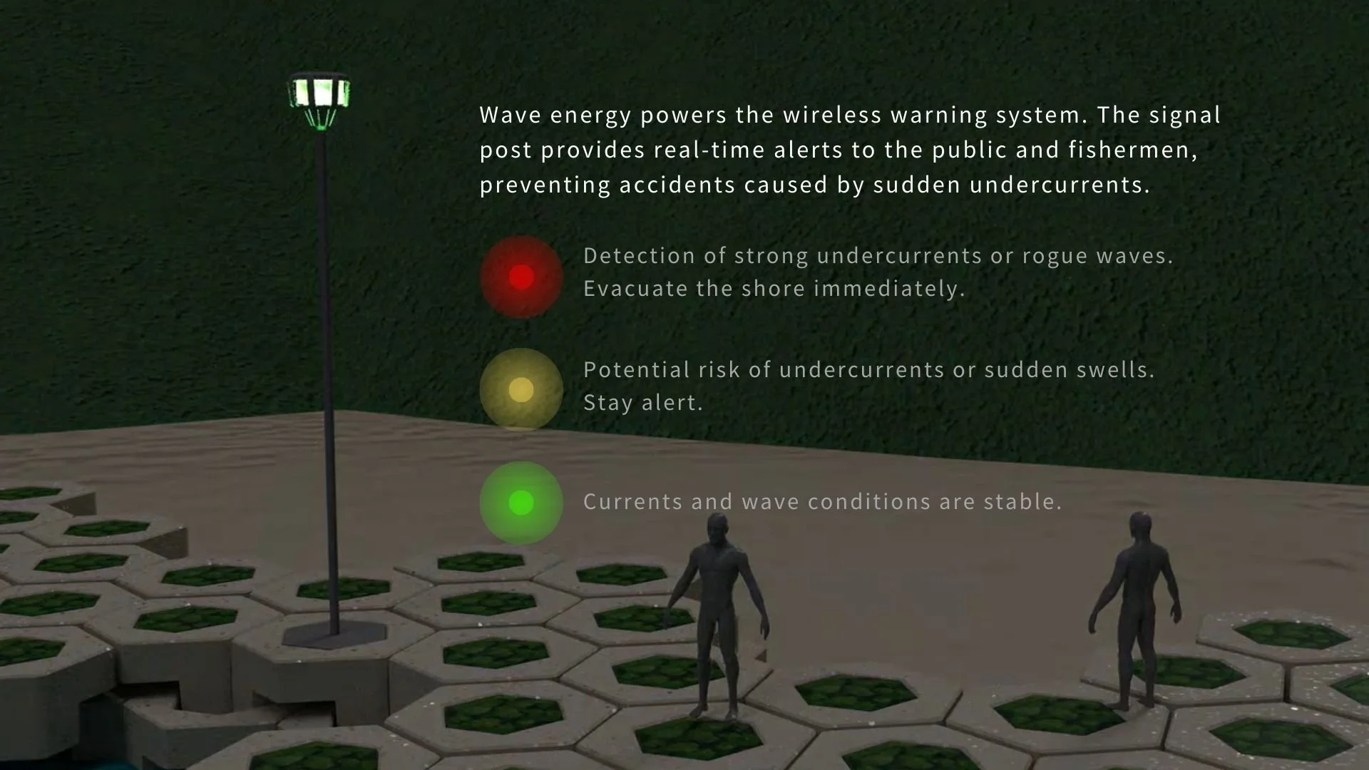
Embedded sensors collect real-time wave data. Our AI model analyzes the patterns to predict rogue waves and detect sudden currents, turning raw data into safety insights.內嵌感測器即時收集浪況資料,AI 模型分析趨勢,預測瘋狗浪、偵測突發暗流,把原始數據轉成安全洞察。
3 · Real-time Warning Service3 · 即時預警服務
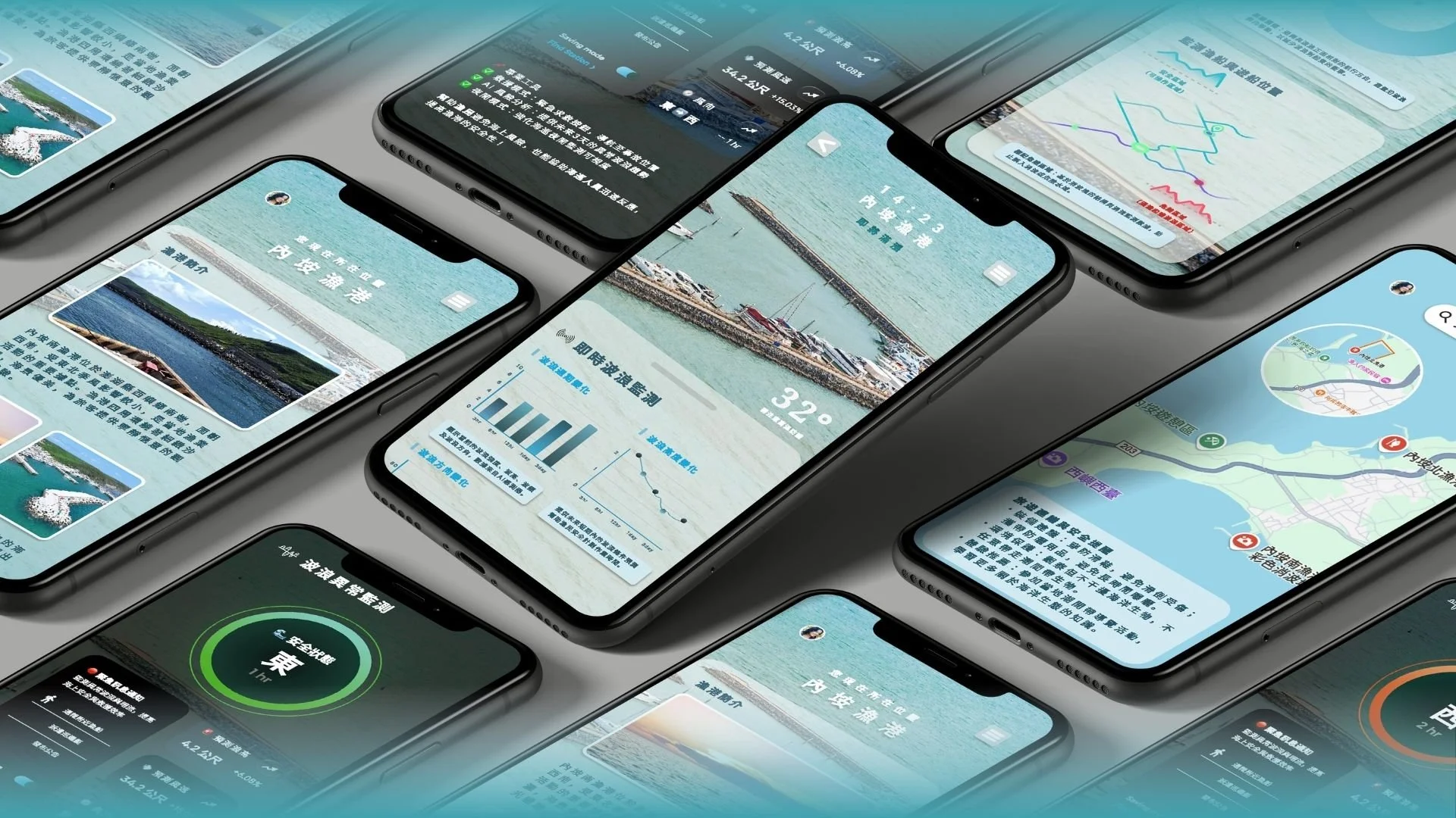
A dedicated app for fishermen and tourists that visualizes ocean risks, with intuitive safety alerts (Safe / Caution / Danger) and GPS-based emergency response.給漁民與遊客的專屬 App,把海洋風險視覺化,用直覺的安全燈號(安全/注意/危險)與 GPS 緊急應變。
Background背景
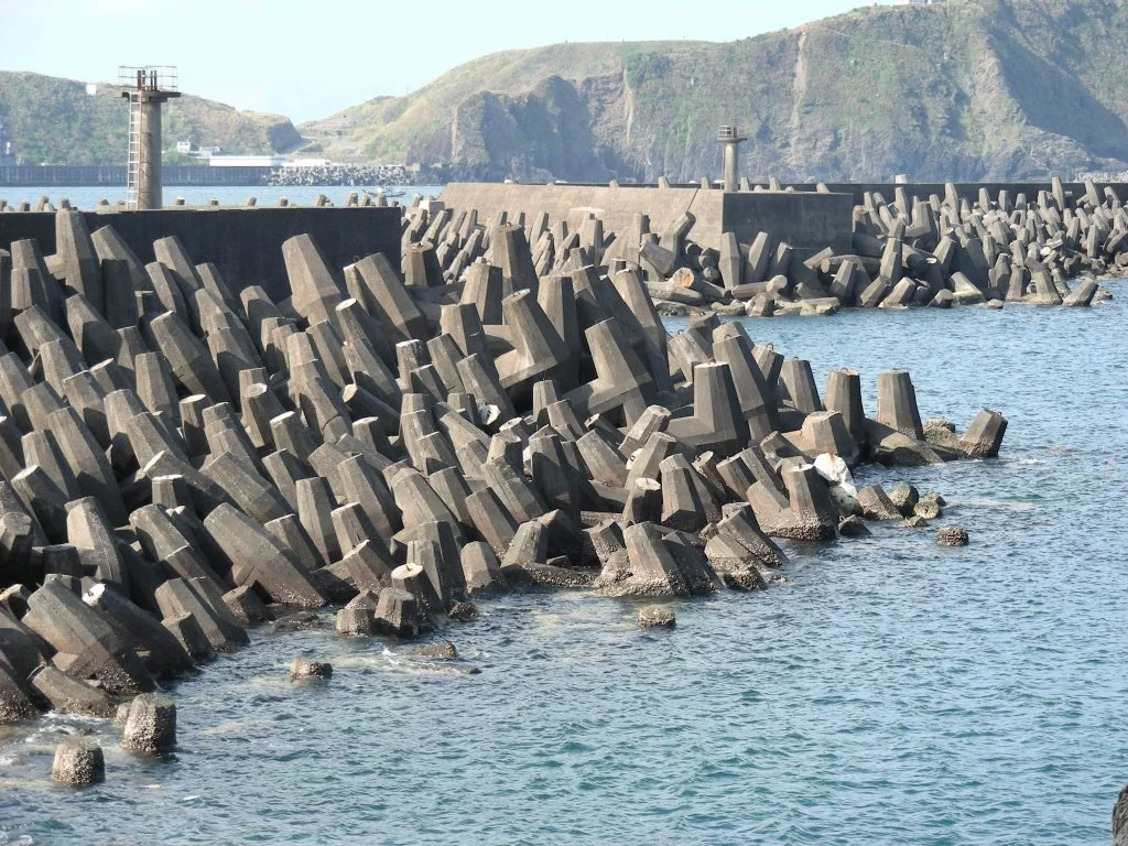
The vanishing coastline. Taiwan, an island nation, has lost nearly 45% of its natural coastline to artificial concrete structures. They prevent erosion, but they also sever the connection between people and the ocean, and severely damage marine ecosystems.正在消失的海岸線。台灣作為島嶼國家,已有將近 45% 的自然海岸線被人工混凝土結構取代。這些結構雖能防止侵蝕,卻也切斷了人與海洋的連結,並嚴重破壞海洋生態。
Problem問題
We narrowed the problem down to three key pain points:我們把問題收斂成三個關鍵痛點:
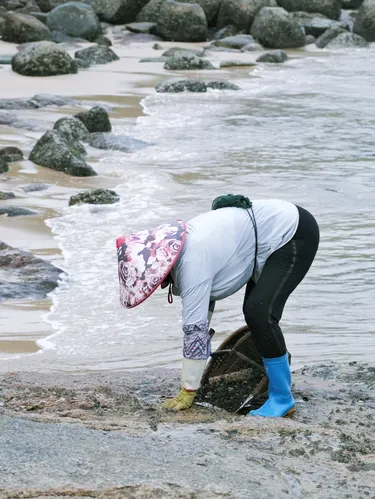
Unpredictable rogue waves and slippery surfaces make intertidal zones dangerous for fishermen and tourists, with no real-time warning for sudden currents.難以預測的瘋狗浪與濕滑地面,讓潮間帶對漁民和遊客都很危險,而突發暗流又沒有即時預警。
Massive concrete blocks destroy marine habitats, reduce biodiversity, and create a "gray wall" that separates communities from the sea.巨大的混凝土塊摧毀海洋棲地、降低生物多樣性,形成一道把社區與海隔開的「灰牆」。
Ocean data (tides, waves) is complex and hard for the average person to access, so risks are consistently underestimated.潮汐、浪況等海洋資料又複雜又難取得,一般人常因此低估風險。
Challenge挑戰
How might we design a coastal defense system that is robust enough to stop waves but porous enough to host life, while translating complex ocean data into intuitive safety signals for people?我們如何設計一套海岸防禦系統,既堅固到能擋浪、又通透到能容納生命,同時把複雜的海洋數據,翻譯成人人看得懂的安全訊號?
User Research使用者研究
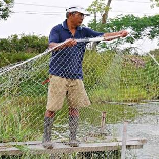
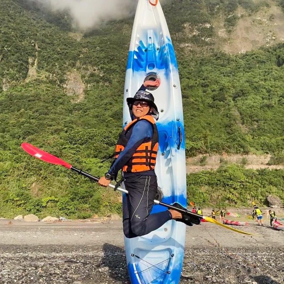
We ran field interviews with local stakeholders in Penghu to understand their daily struggles:我們在澎湖對在地利害關係人做田野訪談,理解他們的日常困境:
Key Insights關鍵洞察
Even experienced fishermen are vulnerable to unpredictable climate shifts. The core need isn't just physical protection, it's the foresight AI can give to anticipate invisible risks like sudden currents.連經驗豐富的漁民,都難以應付難以預測的氣候變化。核心需求不只是實體防護,而是 AI 能提供的預見力,提前預警像突發暗流這種看不見的風險。
Today's coastal infrastructure destroys habitats to protect land. We saw a need for a structure that balances engineering strength with ecological permeability, letting marine life thrive inside the defense system.現有的海岸工程,是用摧毀棲地來保護陸地。我們看到的是一種需求:讓工程強度與生態通透性取得平衡,讓海洋生命能在防禦系統裡繁衍。
Tourists underestimate coastal dangers because there are no visual cues. The design opportunity is to make risk visible, using the app and on-site lighting to translate hidden underwater dangers into a clear visual language.遊客會低估海岸危險,是因為缺乏視覺提示。設計機會就在於「讓風險被看見」:用 App 與現場燈號,把水下看不見的危險翻譯成清楚的視覺語言。
Design Process設計過程
Integrated service ecosystem整合式服務生態系
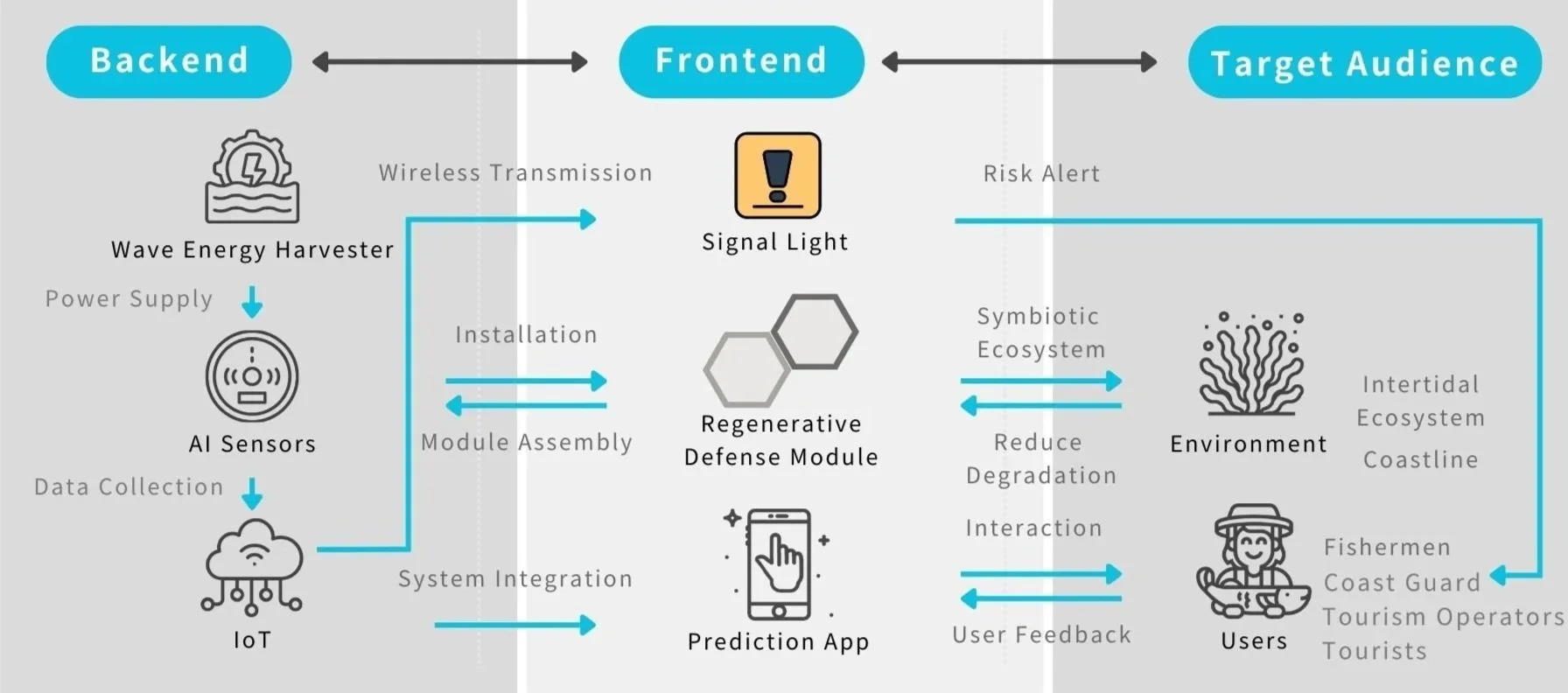
We designed a seamless ecosystem that bridges the physical and digital worlds. The system runs on a three-step loop:我們設計了一套串起實體與數位的服務生態系,靠一個三步驟循環運作:
- Sense (hardware):感測(硬體): IoT sensors embedded in the modules collect wave height, frequency, and current-velocity data. 嵌在模組裡的 IoT 感測器收集浪高、頻率與流速資料。
- Analyze (cloud AI):分析(雲端 AI): Data is sent to the cloud via 5G/IoT, where AI models identify rogue-wave patterns and predict potential risks. 資料透過 5G/IoT 上傳雲端,AI 模型辨識瘋狗浪型態、預測潛在風險。
- Act (interface):行動(介面): Safety signals are instantly pushed to on-site warning lights and the user's mobile app. 安全訊號即時推送到現場警示燈與使用者的手機 App。
Bio-receptive engineering親生物工程
To replace the alienating "gray walls" of traditional concrete, we engineered a structure built around coexistence:為了取代傳統混凝土那種疏離的「灰牆」,我們設計了一個以共存為核心的結構:
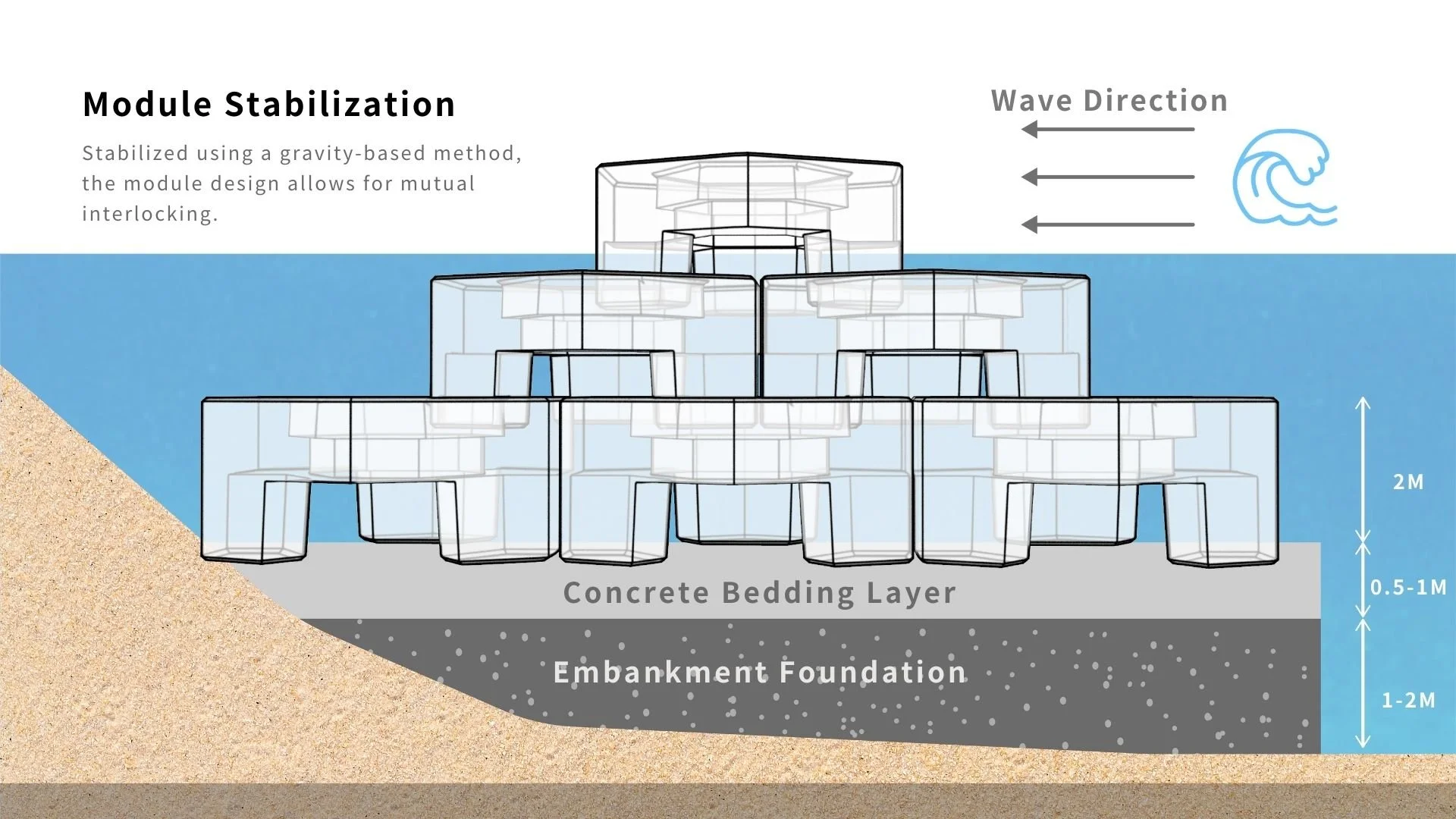
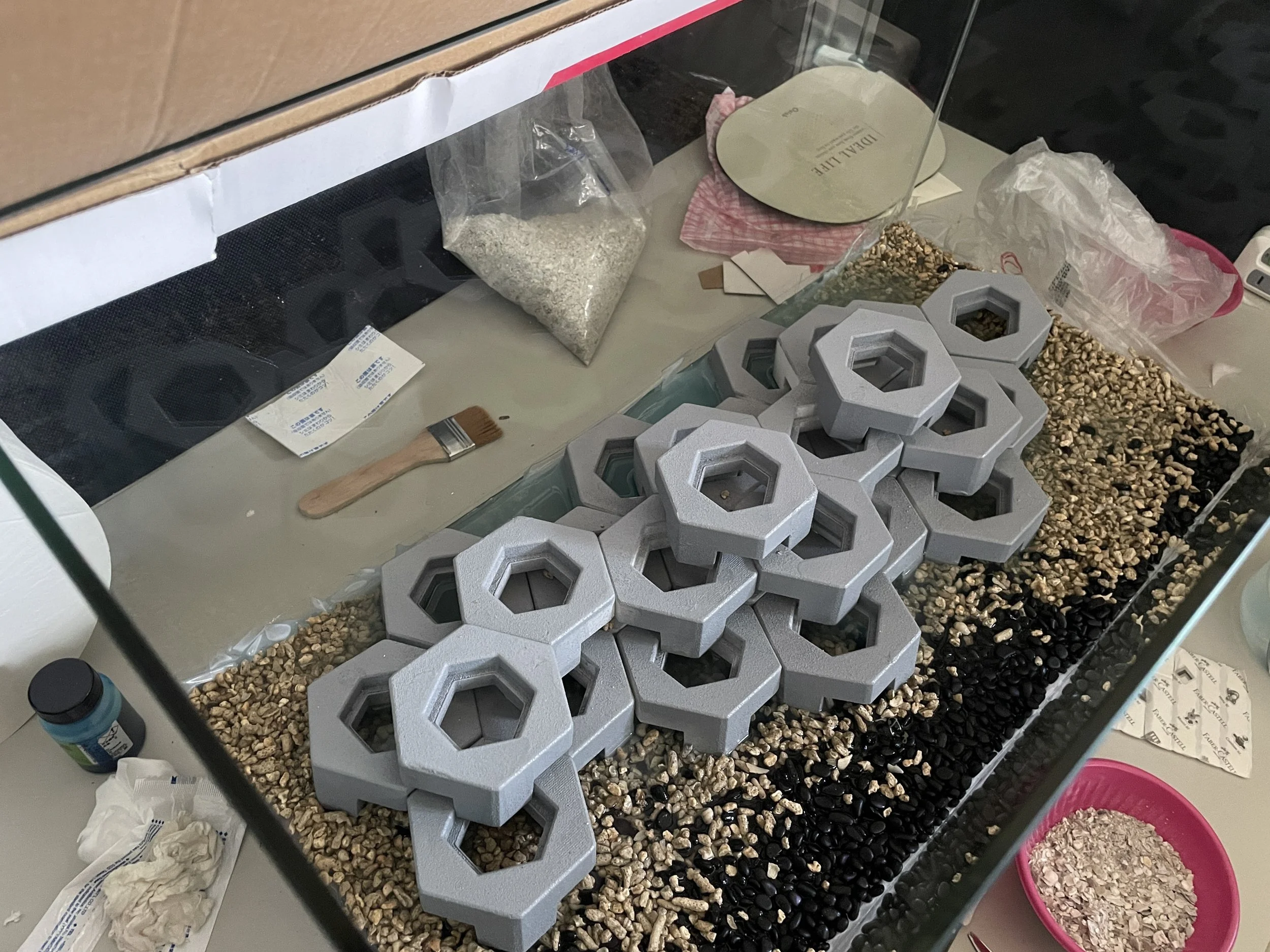
- Modular hexagons:模組化六角形: The interlocking hexagon is a stable barrier against waves and, at the same time, a flat, walkable platform so people can safely reach the intertidal zone. 互扣的六角形既是穩固的擋浪屏障,也形成平坦、可行走的平台,讓人能安全走到潮間帶。
- Sustainable materiality:永續材料: Recycled oyster shells (CaCO3) as a cement aggregate cut carbon emissions and create a porous texture that encourages algae growth and marine-habitat restoration. 用回收蚵殼(碳酸鈣)作為水泥骨材,降低碳排,並形成多孔質地,促進藻類生長與海洋棲地復育。
The Coastal Guard app海岸守護 App
We designed the interface to be high-contrast and glanceable, so fishermen can read it clearly even under harsh sunlight or on a rocking boat:介面設計成高對比、一眼可讀,讓漁民即使在強烈陽光下、或在搖晃的船上,都能看清楚:
- Real-time dashboard:即時儀表板: Instead of complex graphs, a simple traffic-light system (green / yellow / red) shows the safety level instantly. 不用複雜圖表,用簡單的紅黃綠燈號,一眼就知道安全等級。
- Rogue-wave alert:瘋狗浪警報: A dedicated alarm triggers 30 minutes before a predicted dangerous swell, giving fishermen time to evacuate. 專屬警報會在預測危險浪湧的 30 分鐘前觸發,讓漁民有時間撤離。
- Emergency SOS:緊急 SOS: A one-tap rescue button sends GPS coordinates straight to the Coast Guard, cutting response time in an accident. 一鍵求救按鈕直接把 GPS 座標傳給海巡,縮短事故時的反應時間。
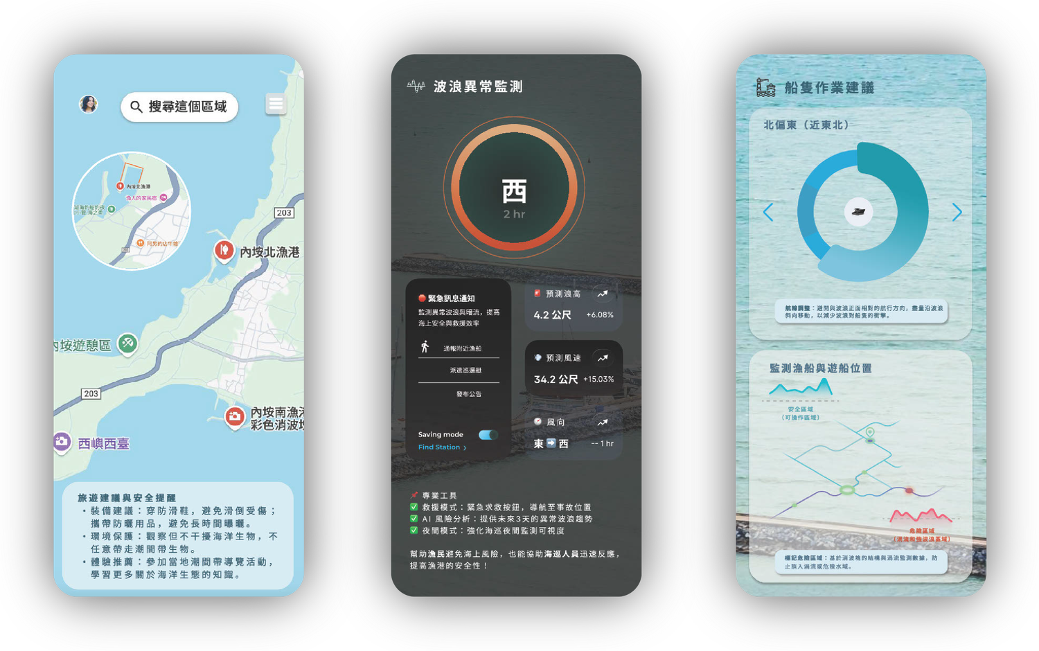
💡 Design rationale, accessibility in extreme conditions. We prioritized large tap targets and high-contrast typography, because our primary users (fishermen) often operate with wet hands, in bright outdoor environments where screen visibility is low.💡 設計理由:極端環境下的可用性。我們優先做大的點按範圍與高對比字體,因為主要使用者(漁民)常常是濕著手、在強光戶外操作,螢幕能見度很低。
Projected Impact預期影響
Reflection & Takeaways反思與收穫

Technology should not distance us from nature, but help us understand it better.科技不該讓我們遠離自然,而是幫助我們更理解自然。
Early on, we leaned too heavily on the AI technology itself. But interviews with people like Grandma Hong and Mr. Xiao reminded us that technology is only a tool, and the real goal is peace of mind. That insight pushed us to shift the design away from complex data charts toward simple, easily understood safety signals.一開始,我們太偏重 AI 技術本身。但和洪奶奶、蕭先生這些人的訪談提醒了我們:技術只是工具,真正的目標是「安心」。這個洞察讓我們把設計從複雜的數據圖表,轉向簡單、好懂的安全訊號。